Stream Bank Erosion Site MR-13
Total Severity: Severe
Total Points: 38
Information collected by:
Maple River Watershed,
Maple River Twp,
Emmet County
GPS Coordinates: 45.53943
, -84.76099
T36N
R4W
Sec 11
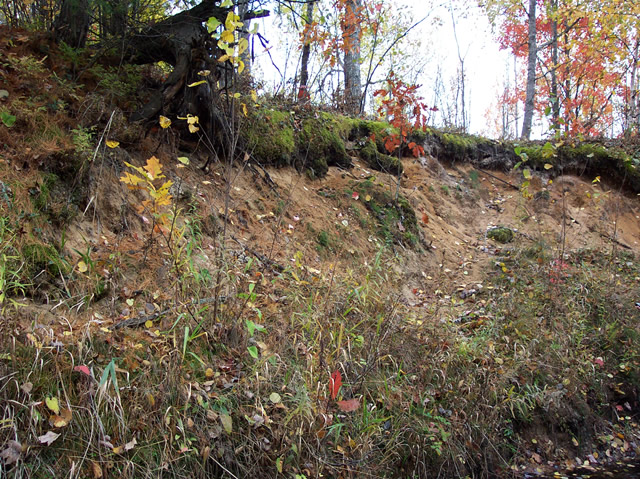
Bank Details
Which Bank? Left
Bank Aspect:W
Condition:Both toe and upper bank eroding
Erosion Trend:Increasing
Percent Veg. Cover: 10-50%
Bank Conditions
Stream Width:25 ft.
Stream Depth:1 ft.
Stream Current:Slow
Eroded Bank Length:30 ft.
Eroded Bank Height:23 ft.
Slope of Eroded Bank:1:1
Texture: Sand
Cause(s) of Erosion
-Bend in river
Other causes: steep slope
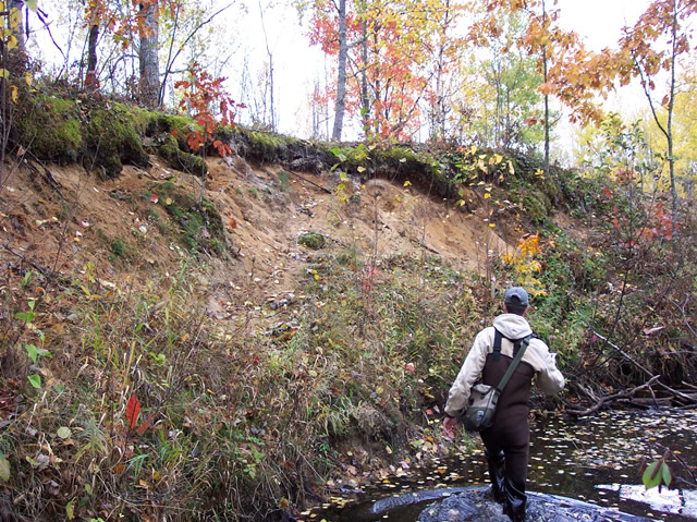
Recommended Treatment(s)
-Bank revegetation
-Rock riprap
Other Treatments:log terracing
General Information
opening on bank above, cedars just before in river, oak on bank above
Total Points
38
�