Stream Bank Erosion Site PM-11
Total Severity: Minor
Total Points: 28
Information collected by:
Pere Marquette River Watershed,
Pere Marquette River
Sweetwater Twp,
Lake County
GPS Coordinates: 43.92597
, -86.00524
T20N
R15W
Sec 29
Owned by State
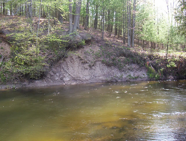
Bank Details
Which Bank? Right
Bank Aspect:SW
Condition:Both toe and upper bank eroding
Erosion Trend:Increasing
Percent Veg. Cover: 50-100%
Bank Conditions
Stream Width:30 ft.
Stream Depth:5 ft.
Stream Current:Fast
Eroded Bank Length:50 ft.
Eroded Bank Height:15 ft.
Slope of Eroded Bank:3:1
Texture: Loam
Cause(s) of Erosion
-Bank seepage
-Foot traffic
Recommended Treatment(s)
-Bank revegetation
-Rock riprap
General Information
Across from Sulac Landing Boat Launch
Total Points
28
�