Stream Bank Erosion Site PM-001
Total Severity: Severe
Total Points: 32
Information collected by:
Pere Marquette River Watershed,
Big South Branch
Beaver Twp,
Newaygo County
GPS Coordinates: 43.7133323833207
, -85.9534692764282
T15N
R14W
Sec 2
Owned by Federal
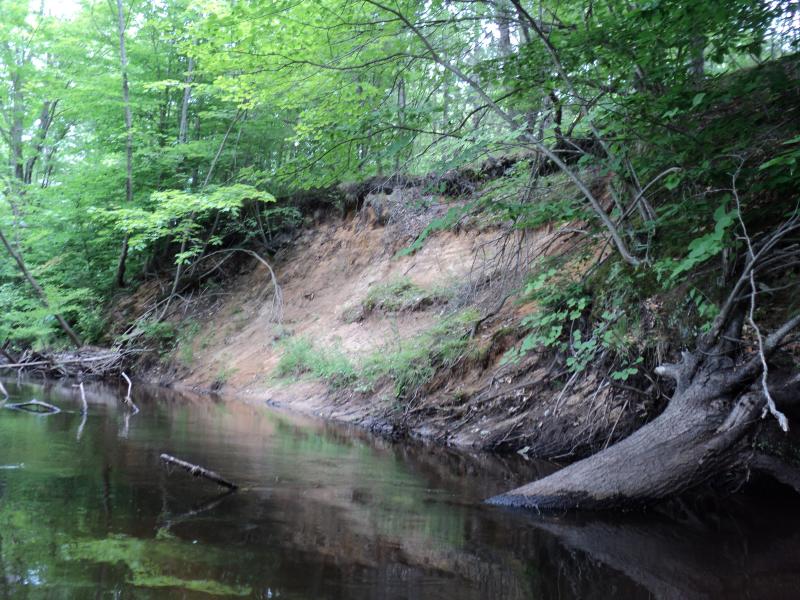
Bank Details
Which Bank? Right
Bank Aspect:W
Condition:Both toe and upper bank eroding
Erosion Trend:Increasing
Percent Veg. Cover: 0-10%
Bank Conditions
Stream Width:30 ft.
Stream Depth:1.5 ft.
Stream Current:Slow
Eroded Bank Length:50 ft.
Eroded Bank Height:18 ft.
Slope of Eroded Bank:2:1
Texture: Sand
Cause(s) of Erosion
-Bend in river
Recommended Treatment(s)
-Bank revegetation
-Rock riprap
-Tree revetments
General Information
BMPs Completed:
GPS coordinates are an estimate. GPS or operator were not functioning properly. Site is first one downstream from 11 Mile Rd.
Total Points
32
�