Stream Bank Erosion Site PM-006
Total Severity: Severe
Total Points: 36
Information collected by:
Pere Marquette River Watershed,
Big South Branch
Troy Twp,
Newaygo County
GPS Coordinates: 43.73167
, -85.95555
T16N
R14W
Sec 35
Owned by Federal
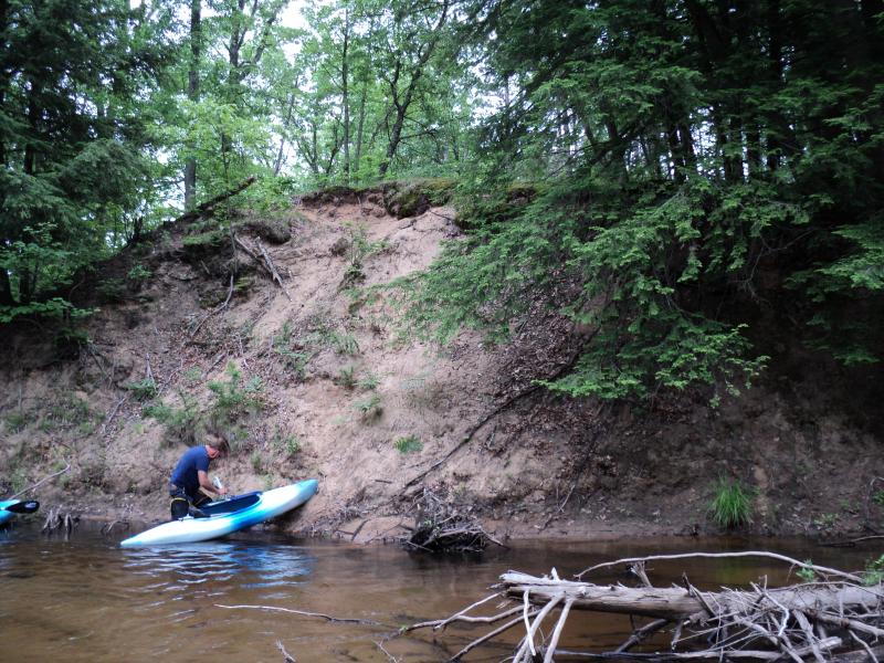
Bank Details
Which Bank? Right
Bank Aspect:W
Condition:Both toe and upper bank eroding
Erosion Trend:Increasing
Percent Veg. Cover: 0-10%
Bank Conditions
Stream Width:45 ft.
Stream Depth:1 ft.
Stream Current:Slow
Eroded Bank Length:85 ft.
Eroded Bank Height:25 ft.
Slope of Eroded Bank:2:1
Texture: Sand
Cause(s) of Erosion
-Bend in river
Other causes: Steepness, Sediment accumulation in channel
Recommended Treatment(s)
-Bank revegetation
General Information
BMPs Completed:
Near Red Pine plantation.
Total Points
36
�