Stream Bank Erosion Site PM-007
Total Severity: Severe
Total Points: 33
Information collected by:
Pere Marquette River Watershed,
Big South Branch
Troy Twp,
Newaygo County
GPS Coordinates: 43.74242
, -85.96315
T16N
R14W
Sec 27
Owned by Federal
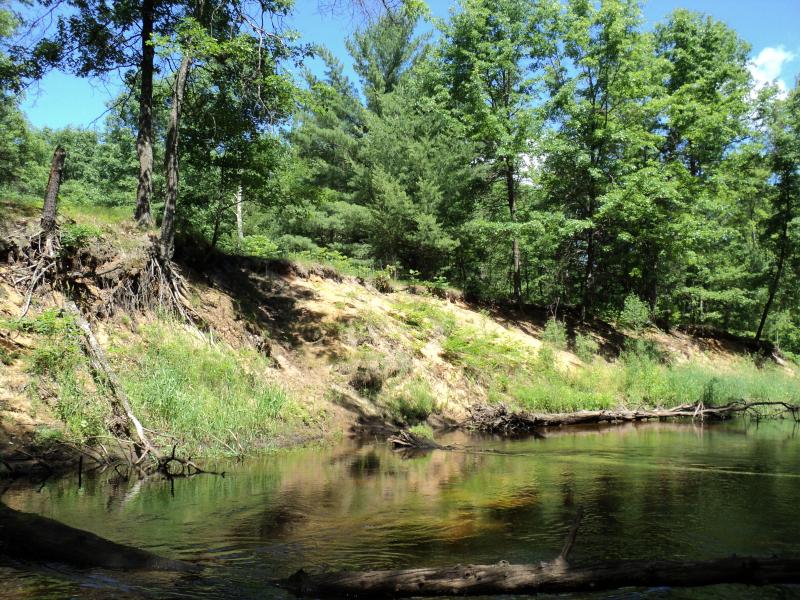
Bank Details
Which Bank? Left
Bank Aspect:E
Condition:Both toe and upper bank eroding
Erosion Trend:Increasing
Percent Veg. Cover: 10-50%
Bank Conditions
Stream Width:28 ft.
Stream Depth:3 ft.
Stream Current:Slow
Eroded Bank Length:200+ ft.
Eroded Bank Height:10 ft.
Slope of Eroded Bank:2:1
Texture: Sand
Cause(s) of Erosion
-Bend in river
Recommended Treatment(s)
-Bank revegetation
-Rock riprap
-Tree revetments
General Information
Total Points
33
�