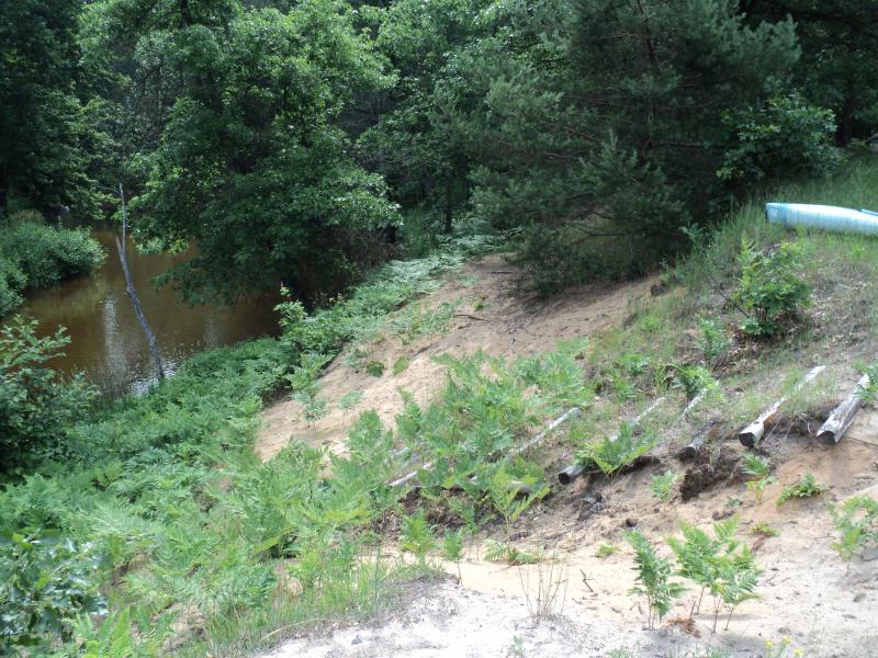
Stream Bank Erosion Site PM-013
Total Severity: Moderate
Total Points: 28
Information collected by:
Pere Marquette River Watershed,
Big South Branch
Troy Twp,
Newaygo County
GPS Coordinates: 43.7748
, -85.995
T16N
R14W
Sec 16
Owned by Federal
Bank Details
Which Bank? Left
Bank Aspect:NE
Condition:Toe is Stable, upper bank eroding
Erosion Trend:Increasing
Percent Veg. Cover: 50-100%
Bank Conditions
Stream Width:30 ft.
Stream Depth:3 ft.
Stream Current:Slow
Eroded Bank Length:100 ft.
Eroded Bank Height:22 ft.
Slope of Eroded Bank:3:1
Texture: Sand
Cause(s) of Erosion
-Foot traffic
Recommended Treatment(s)
-Bank revegetation
-Constructed access
General Information
BMPs Completed:
Platform structure at toe. USA campsite. Access off of Dickinson ave. to 14 mile rd. (Forest Service road # 5003) then to Forest Service Road # 6047.
Total Points
28
�