Stream Bank Erosion Site PM-090
Total Severity: Minor
Total Points: 23
Information collected by:
Pere Marquette River Watershed,
Big South Branch
Logan Twp,
Mason County
GPS Coordinates: 43.89114
, -86.15888
T17N
R15W
Sec 7
Owned by Federal
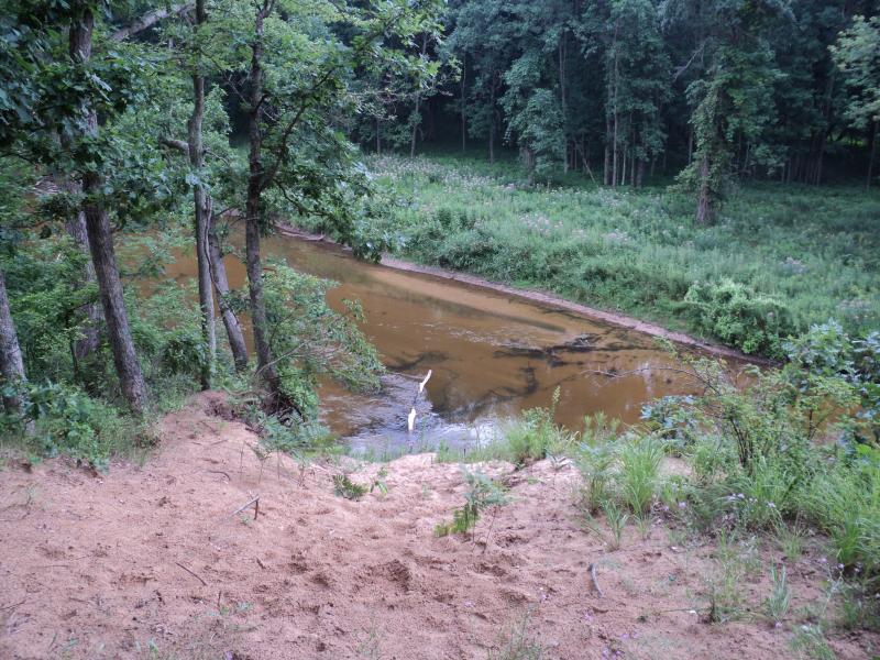
Bank Details
Which Bank? Left
Bank Aspect:SE
Condition:Both toe and upper bank eroding
Erosion Trend:Stable
Percent Veg. Cover: 50-100%
Bank Conditions
Stream Width:35 ft.
Stream Depth:1.5 ft.
Stream Current:Slow
Eroded Bank Length:15 ft.
Eroded Bank Height:38 ft.
Slope of Eroded Bank:2:1
Texture: Sand
Cause(s) of Erosion
-Foot traffic
Recommended Treatment(s)
-Constructed access
General Information
BMPs Completed:
Access off Indian Trail rd.
Total Points
23
�