Stream Bank Erosion Site pine-013
Total Severity: Minor
Total Points: 29
Information collected by:
Pine River Watershed,
Ellsworth Twp,
Lake County
GPS Coordinates: 44.06645939
, -85.60443287
T19N
R11W
Sec 3
Owned by Private
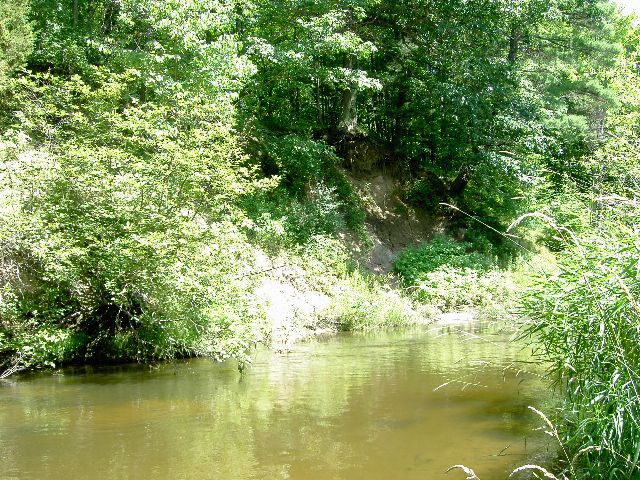
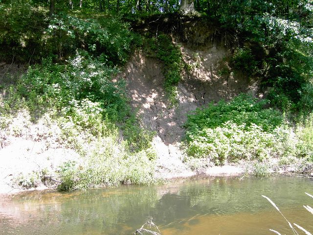
Bank Details
Which Bank? Left
Bank Aspect:SE
Condition:Toe is stable; upper bank eroding
Erosion Trend:Increasing
Percent Veg. Cover: 10-50%
Bank Conditions
Stream Width:30 ft.
Stream Depth:3 ft.
Stream Current:Slow
Eroded Bank Length:30 ft.
Eroded Bank Height:40 ft.
Slope of Eroded Bank:3:1
Texture: Sand
Clay
Stratified
Clay
Stratified
Cause(s) of Erosion
-Bend in river
Other causes: Spring runoff
Recommended Treatment(s)
-Bank revegetation
-Rock riprap
General Information
Total Points
29
�