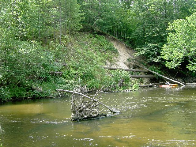
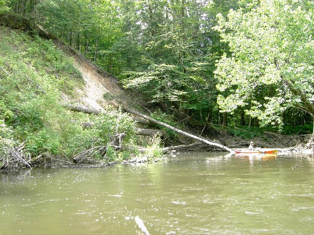
Stream Bank Erosion Site pine-015
Total Severity: Moderate
Total Points: 31
Information collected by:
Pine River Watershed,
Ellsworth Twp,
Lake County
GPS Coordinates: 44.06655825
, -85.61137967
T19N
R11W
Sec 3
Owned by State
Bank Details
Which Bank? Left
Bank Aspect:N
Condition:Both toe and upper bank eroding
Erosion Trend:Increasing
Percent Veg. Cover: 50-100%
Bank Conditions
Stream Width:35 ft.
Stream Depth:6 ft.
Stream Current:Slow
Eroded Bank Length:30 ft.
Eroded Bank Height:30 ft.
Slope of Eroded Bank:2:1
Texture: Sand
Cause(s) of Erosion
-Bend in river
Other causes: eddie from past treatment
Recommended Treatment(s)
Other Treatments:woody debris
General Information
Total Points
31
�