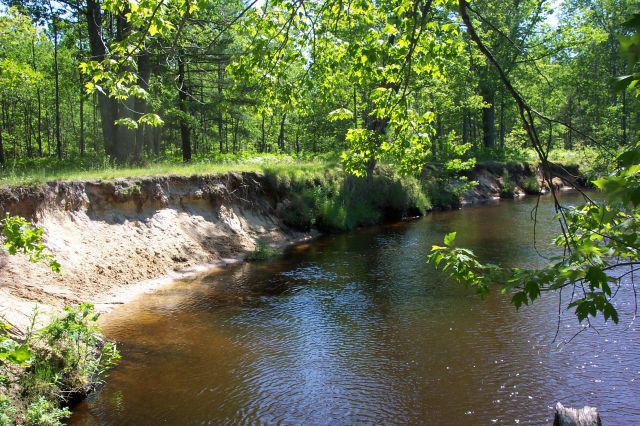
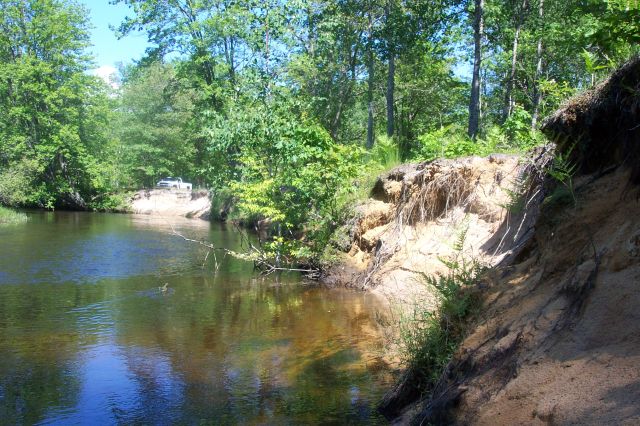
Stream Bank Erosion Site BSR-03
Total Severity: Severe
Total Points: 37
Information collected by:
Big Sable River Watershed,
Sheridan Twp,
Mason County
GPS Coordinates: 44.07448
, -86.0864
T19N
R15W
Sec 3
Owned by Federal
Bank Details
Which Bank? Left
Bank Aspect:NW
Condition:Both toe and upper bank eroding
Erosion Trend:Increasing
Percent Veg. Cover: 0-10%
Bank Conditions
Stream Width:30 ft.
Stream Depth:4 ft.
Stream Current:Slow
Eroded Bank Length:180 ft.
Eroded Bank Height:6 ft.
Slope of Eroded Bank:4:1 or greater
Texture: Sand
Cause(s) of Erosion
-Bend in river
-Foot traffic
Other causes: Boats and foot traffic are beating up streambank
Recommended Treatment(s)
-Bank revegetation
-Rock riprap
-Tree revetments
-Constructed access
Other Treatments:Canoe/Kayak Launch
General Information
Canoe Access Site near Pole Bridge
Total Points
37
�