Stream Bank Erosion Site pine-032
Total Severity: Minor
Total Points: 27
Information collected by:
Pine River Watershed,
North Newkirk Twp,
Lake County
GPS Coordinates: 44.12798939
, -85.68993471
T20N
R12W
Sec 13
Owned by State
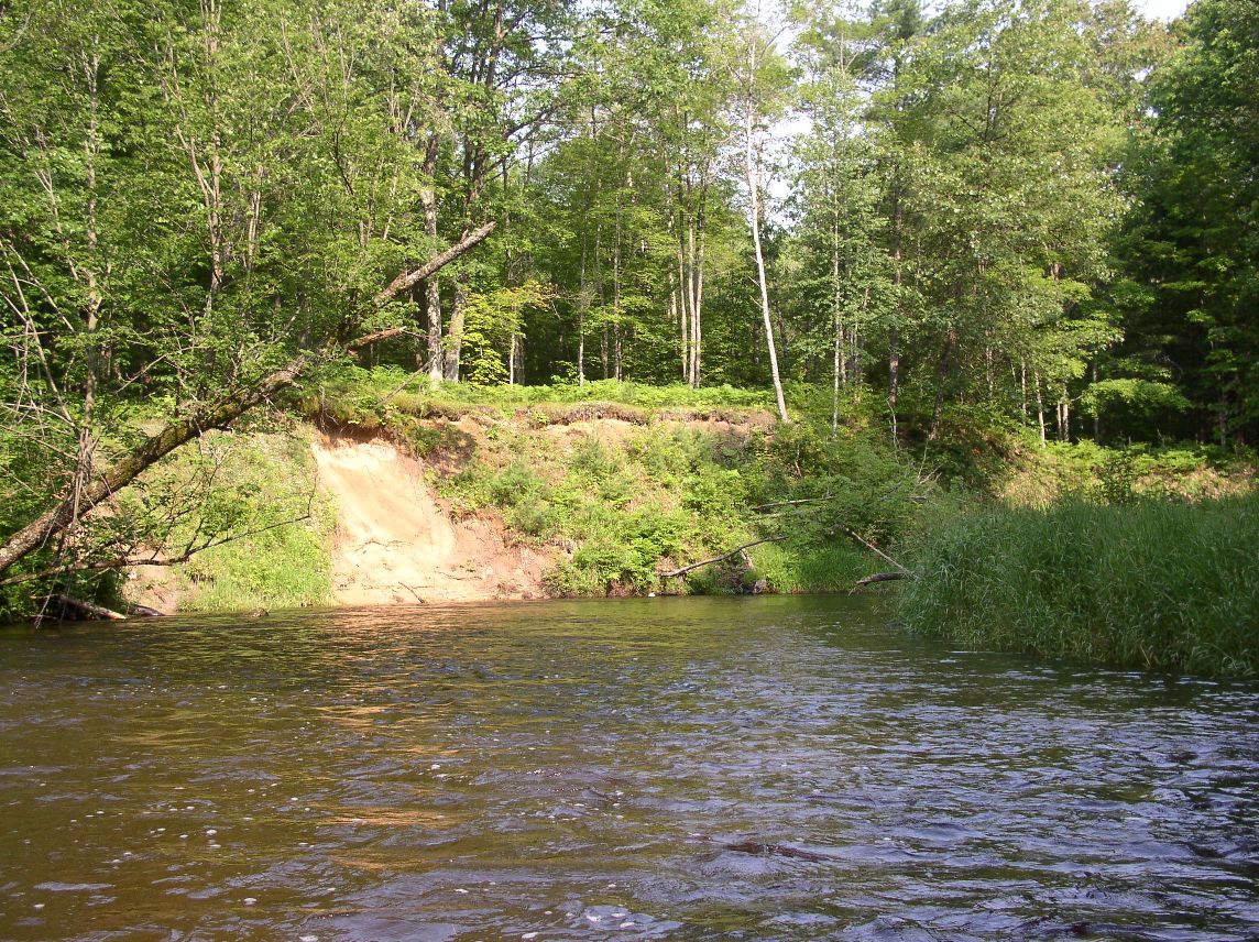
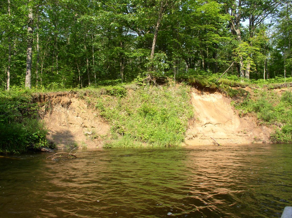
Bank Details
Which Bank? Left
Bank Aspect:W
Condition:Toe is undercutting
Erosion Trend:Increasing
Percent Veg. Cover: 50-100%
Bank Conditions
Stream Width:30 ft.
Stream Depth:4 ft.
Stream Current:Fast
Eroded Bank Length:50 ft.
Eroded Bank Height:12 ft.
Slope of Eroded Bank:3:1
Texture: Sand
Cause(s) of Erosion
Other causes: high water slumping
Recommended Treatment(s)
-Bank revegetation
General Information
Total Points
27
�