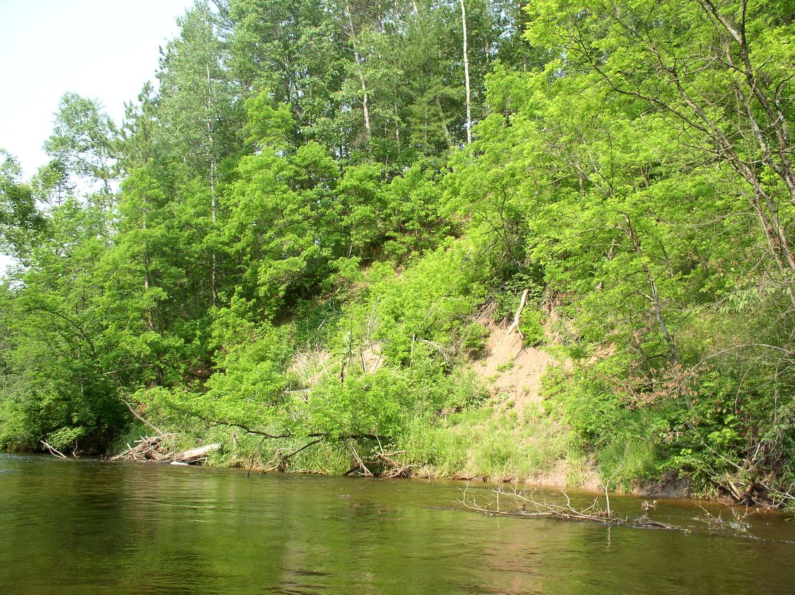
Stream Bank Erosion Site pine-036
Total Severity: Severe
Total Points: 36
Information collected by:
Pine River Watershed,
North Newkirk Twp,
Lake County
GPS Coordinates: 44.14303815
, -85.69711433
T20N
R12W
Sec 12
Owned by Federal

Bank Details
Which Bank? Right
Bank Aspect:NW
Condition:Both toe and upper bank eroding
Erosion Trend:Increasing
Percent Veg. Cover: 10-50%
Bank Conditions
Stream Width:25 ft.
Stream Depth:3 ft.
Stream Current:Fast
Eroded Bank Length:60 ft.
Eroded Bank Height:65 ft.
Slope of Eroded Bank:3:1
Texture: Sand
Clay
Clay
Cause(s) of Erosion
-Bend in river
Other causes: High water slump. Roll away
Recommended Treatment(s)
-Bank revegetation
-Rock riprap
General Information
Total Points
36
�