Stream Bank Erosion Site pine-064
Total Severity: Moderate
Total Points: 31
Information collected by:
Pine River Watershed,
South Branch Twp,
Wexford County
GPS Coordinates: 44.19856532
, -85.77708652
T21N
R12W
Sec 21
Owned by Federal
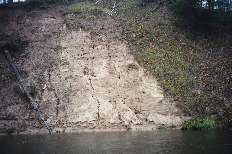
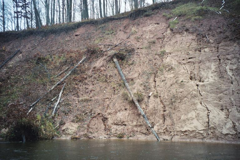
Bank Details
Which Bank? Right
Bank Aspect:S
Condition:Toe is undercutting
Erosion Trend:Increasing
Percent Veg. Cover: 10-50%
Bank Conditions
Stream Width:40 ft.
Stream Depth:3 ft.
Stream Current:Slow
Eroded Bank Length:40 ft.
Eroded Bank Height:40 ft.
Slope of Eroded Bank:3:1
Texture: Sand
Clay
Clay
Cause(s) of Erosion
-Bend in river
Recommended Treatment(s)
-Bank revegetation
-Rock riprap
General Information
Total Points
31
�