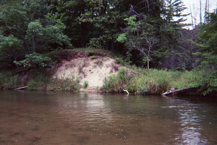
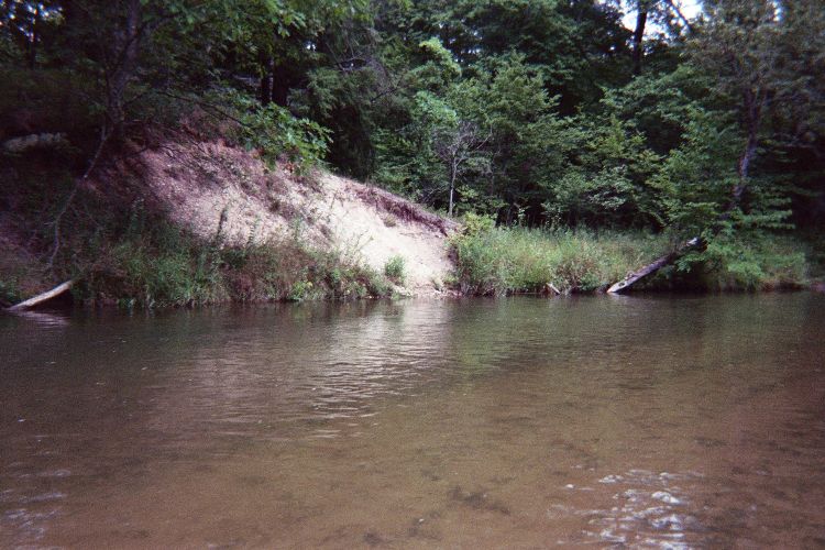
Stream Bank Erosion Site pine-090
Total Severity: Moderate
Total Points: 34
Information collected by:
Pine River Watershed,
East Norman Twp,
Manistee County
GPS Coordinates: 44.2040155
, -85.82459026
T21N
R13W
Sec 24
Owned by Federal
Bank Details
Which Bank? Right
Bank Aspect:SW
Condition:Both toe and upper bank eroding
Erosion Trend:Increasing
Percent Veg. Cover: 0-10%
Bank Conditions
Stream Width:40 ft.
Stream Depth:3 ft.
Stream Current:Fast
Eroded Bank Length:20 ft.
Eroded Bank Height:12 ft.
Slope of Eroded Bank:2:1
Texture: Sand
Gravel
Gravel
Cause(s) of Erosion
-Bend in river
Recommended Treatment(s)
-Cover structure
-Tree revetments
General Information
Total Points
34
�