Stream Bank Erosion Site BSR-14
Total Severity: Minor
Total Points: 26
Information collected by:
Big Sable River Watershed,
Meade Twp,
Mason County
GPS Coordinates: 44.0851
, -86.11152
T20N
R15W
Sec 33
Owned by State
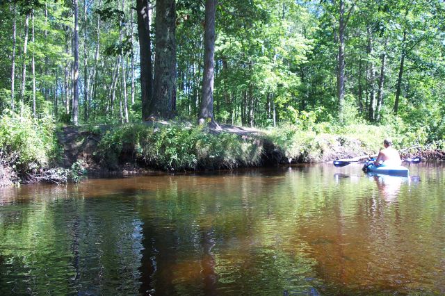

Bank Details
Which Bank? Left
Bank Aspect:NW
Condition:Toe is undercutting
Erosion Trend:Increasing
Percent Veg. Cover: 10-50%
Bank Conditions
Stream Width:20 ft.
Stream Depth:2 ft.
Stream Current:Slow
Eroded Bank Length:40 ft.
Eroded Bank Height:3 ft.
Slope of Eroded Bank:4:1 or greater
Texture: Sand
Cause(s) of Erosion
-Foot traffic
Recommended Treatment(s)
-Rock riprap
-Constructed access
General Information
Total Points
26
�