Stream Bank Erosion Site BSR-15
Total Severity: Minor
Total Points: 24
Information collected by:
Big Sable River Watershed,
Meade Twp,
Mason County
GPS Coordinates: 44.08707
, -86.11443
T20N
R15W
Sec 33
Owned by State
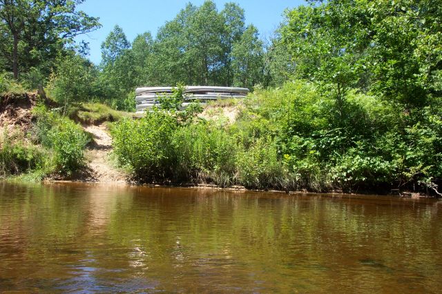
Bank Details
Which Bank? Left
Bank Aspect:N
Condition:Toe is stable; upper bank eroding
Erosion Trend:Increasing
Percent Veg. Cover: 10-50%
Bank Conditions
Stream Width:30 ft.
Stream Depth:1 ft.
Stream Current:Slow
Eroded Bank Length:25 ft.
Eroded Bank Height:12 ft.
Slope of Eroded Bank:1:1
Texture: Sand
Cause(s) of Erosion
-Foot traffic
Other causes: Canoe Landing
Recommended Treatment(s)
-Bank revegetation
-Constructed access
General Information
Canoe access site
Total Points
24
�