Stream Bank Erosion Site MAN-59
Total Severity: Minor
Total Points: 18
Information collected by:
Little Manistee River Watershed,
East Stronach Twp,
Manistee County
GPS Coordinates: 44.17098333
, -86.09123333
T21N
R15W
Sec 35
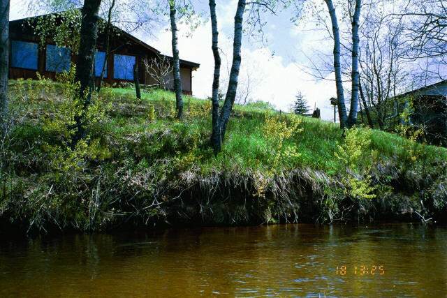
Bank Details
Which Bank? Right
Bank Aspect:W
Condition:Toe is undercutting
Erosion Trend:Increasing
Percent Veg. Cover: 50-100%
Bank Conditions
Stream Width:45 ft.
Stream Depth:3 ft.
Stream Current:Slow
Eroded Bank Length:40 ft.
Eroded Bank Height:10 ft.
Slope of Eroded Bank:2:1
Texture: Clay
Cause(s) of Erosion
-Bend in river
Recommended Treatment(s)
-Tree revetments
Other Treatments:Some stabilization efforts by landowner
General Information
Total Points
18
�