Stream Bank Erosion Site MAN-68
Total Severity: Moderate
Total Points: 30
Information collected by:
Little Manistee River Watershed,
East Stronach Twp,
Manistee County
GPS Coordinates: 44.1768
, -86.15091667
T21N
R15W
Sec 32
Owned by Federal
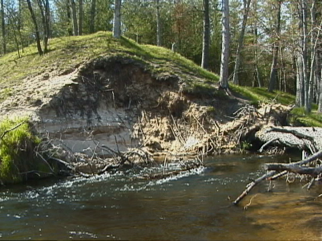
Bank Details
Which Bank? Right
Bank Aspect:SE
Condition:Both toe and upper bank eroding
Erosion Trend:Increasing
Percent Veg. Cover: 0-10%
Bank Conditions
Stream Width:50 ft.
Stream Depth:4 ft.
Stream Current:Fast
Eroded Bank Length:40 ft.
Eroded Bank Height:35 ft.
Slope of Eroded Bank:4:1 or greater
Texture: Sand
Cause(s) of Erosion
-Obstructions in river
-Bend in river
Recommended Treatment(s)
-Rock riprap
-Tree revetments
Other Treatments:No previous stabilization efforts
General Information
Total Points
30
�