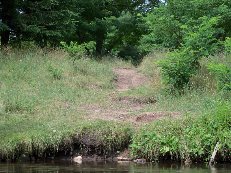
Stream Bank Erosion Site RIF_Rec5
Total Severity: Minor
Total Points: 17
Information collected by:
Rifle River Watershed,
Rifle River Main Branch
Cumming Twp,
Ogemaw County
GPS Coordinates: 44.39528
, -84.03861
R3E
Owned by State
Site Access:Accessible by road
Bank Details
Which Bank? Left
Bank Aspect:NW
Condition:Toe is stable; upper bank eroding
Erosion Trend:Increasing
Percent Veg. Cover: 4:1 or flatter
Bank Conditions
Stream Width:25 ft.
Stream Depth:1 ft.
Stream Current:Slow
Eroded Bank Length:5 ft.
Eroded Bank Height:3 ft.
Slope of Eroded Bank:4:1 or flatter
Texture: Sand
Cause(s) of Erosion
-Foot traffic
Other causes: campground
Recommended Treatment(s)
-Bank revegetation
-Rock riprap
-Constructed access
Other Treatments:Terrace
General Information
Total Points
17
�