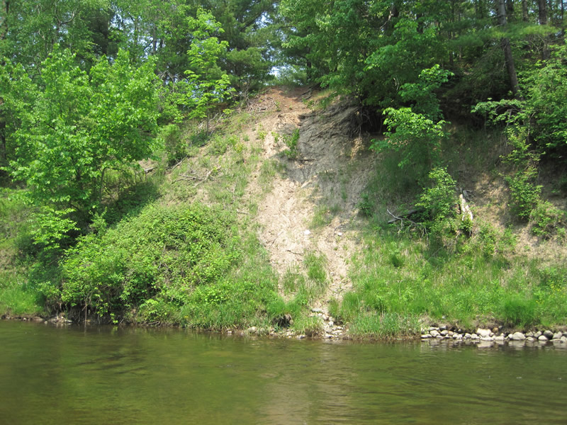
Stream Bank Erosion Site RIF_027
Total Severity: Moderate
Total Points: 35
Information collected by:
Rifle River Watershed,
Rifle River Main Branch
Churchill Twp,
Ogemaw County
GPS Coordinates: 44.27389
, -84.08334
T22N
R3E
Site Access:Accessible by road
Bank Details
Which Bank? Left
Bank Aspect:W
Condition:Toe is stable; upper bank eroding
Erosion Trend:Increasing
Percent Veg. Cover: 11-50%
Bank Conditions
Stream Width:40 ft.
Stream Depth:2 ft.
Stream Current:Fast
Eroded Bank Length:30 ft.
Eroded Bank Height:35 ft.
Slope of Eroded Bank:1:1
Texture: Sand
Clay
Clay
Cause(s) of Erosion
-Foot traffic
Recommended Treatment(s)
-Bank revegetation
-Tree revetments
Other Treatments:Bottom has rock and lunker structures that look okay
General Information
Other Bank info:gravel washout between vegetation on slope
Total Points
35
�