Stream Bank Erosion Site RIF_033
Total Severity: Severe
Total Points: 39
Information collected by:
Rifle River Watershed,
Rifle River Main Branch
Churchill Twp,
Ogemaw County
GPS Coordinates: 44.26694
, -84.07
T22N
R3E
Site Access:Accessible by road
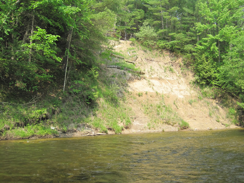
Bank Details
Which Bank? Left
Bank Aspect:W
Condition:Toe and upper bank are eroding
Erosion Trend:Increasing
Percent Veg. Cover: 11-50%
Bank Conditions
Stream Width:30 ft.
Stream Depth:2 ft.
Stream Current:Fast
Eroded Bank Length:200 ft.
Eroded Bank Height:50 ft.
Slope of Eroded Bank:1:1
Texture: Clay
Cause(s) of Erosion
-Bend in river
-Bank seepage
Recommended Treatment(s)
-Bank revegetation
Other Treatments:Rows of biologs
General Information
Total Points
39
�