Stream Bank Erosion Site RIF_044
Total Severity: Moderate
Total Points: 35
Information collected by:
Rifle River Watershed,
Rifle River Main Branch
Mills Twp,
Ogemaw County
GPS Coordinates: 44.240149
, -84.067084
T21N
R3E
Sec 4
Owned by Private
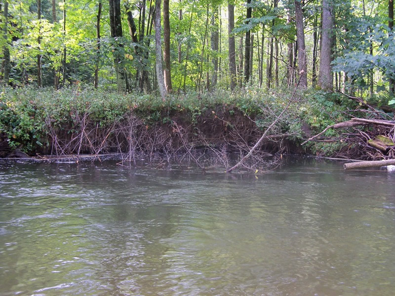
Bank Details
Which Bank? Left
Bank Aspect:NW
Condition:Toe is undercutting
Erosion Trend:Increasing
Percent Veg. Cover: 0-10%
Bank Conditions
Stream Width:30 ft.
Stream Depth:30 ft.
Stream Current:Fast
Eroded Bank Length:105 ft.
Eroded Bank Height:6 ft.
Slope of Eroded Bank:1:1
Texture: Sand over clay
Cause(s) of Erosion
-Bend in river
Recommended Treatment(s)
-Rock riprap
-Tree revetments
General Information
Total Points
35
�