Stream Bank Erosion Site RIF_045
Total Severity: Moderate
Total Points: 35
Information collected by:
Rifle River Watershed,
Rifle River Main Branch
Mills Twp,
Ogemaw County
GPS Coordinates: 44.240221
, -84.066227
T21N
R3E
Sec 4
Owned by Private
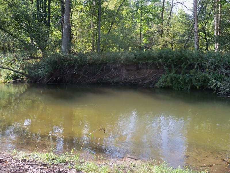
Bank Details
Which Bank? Right
Bank Aspect:E
Condition:Toe is undercutting
Erosion Trend:Increasing
Percent Veg. Cover: 11-50%
Bank Conditions
Stream Width:30 ft.
Stream Depth:30 ft.
Stream Current:Fast
Eroded Bank Length:300 ft.
Eroded Bank Height:8 ft.
Slope of Eroded Bank:1:1
Texture: Sand
Gravel
Gravel
Cause(s) of Erosion
-Bend in river
Recommended Treatment(s)
-Tree revetments
Other Treatments:Some repair has been done at this site, but the length is increasing
General Information
Total Points
35
�