Stream Bank Erosion Site RIF_047
Total Severity: Moderate
Total Points: 29
Information collected by:
Rifle River Watershed,
Rifle River Main Branch
Mills Twp,
Ogemaw County
GPS Coordinates: 44.236981
, -84.068165
T21N
R3E
Sec 4
Owned by Private
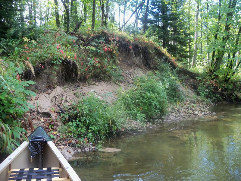
Bank Details
Which Bank? Left
Bank Aspect:W
Condition:Toe and upper bank are eroding
Erosion Trend:Increasing
Percent Veg. Cover: 11-50%
Bank Conditions
Stream Width:25 ft.
Stream Depth:25 ft.
Stream Current:Fast
Eroded Bank Length:25 ft.
Eroded Bank Height:10 ft.
Slope of Eroded Bank:2:01
Texture: Sand
Gravel
Gravel
Cause(s) of Erosion
-Bend in river
Recommended Treatment(s)
-Tree revetments
Other Treatments:Some brush in place (downed trees), but river is cutting behind them
General Information
Other Location info:Oxbow Cutoff
Total Points
29
�