Stream Bank Erosion Site RIF_050
Total Severity: Moderate
Total Points: 35
Information collected by:
Rifle River Watershed,
Rifle River Main Branch
Mills Twp,
Ogemaw County
GPS Coordinates: 44.231524
, -84.068688
T21N
R3E
Sec 9
Owned by Private
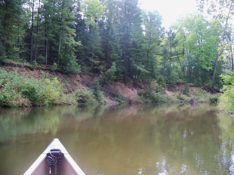
Bank Details
Which Bank? Left
Bank Aspect:W
Condition:Toe and upper bank are eroding
Erosion Trend:Decreasing
Percent Veg. Cover: 11-50%
Bank Conditions
Stream Width:35 ft.
Stream Depth:35 ft.
Stream Current:Slow
Eroded Bank Length:200 ft.
Eroded Bank Height:20 ft.
Slope of Eroded Bank:1:1
Texture: Sand over clay
Cause(s) of Erosion
-Bend in river
Recommended Treatment(s)
-Tree revetments
Other Treatments:Some brush in place, additional needed
General Information
Total Points
35
�