Stream Bank Erosion Site RIF_052
Total Severity: Severe
Total Points: 39
Information collected by:
Rifle River Watershed,
Rifle River Main Branch
Mills Twp,
Ogemaw County
GPS Coordinates: 44.228645
, -84.068759
T21N
R3E
Sec 9
Owned by Private
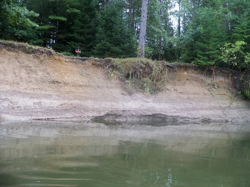
Bank Details
Which Bank? Left
Bank Aspect:W
Condition:Toe and upper bank are eroding
Erosion Trend:Increasing
Percent Veg. Cover: 0-10%
Bank Conditions
Stream Width:40 ft.
Stream Depth:40 ft.
Stream Current:Slow
Eroded Bank Length:250 ft.
Eroded Bank Height:20 ft.
Slope of Eroded Bank:1:01
Texture: Sand over clay
Cause(s) of Erosion
Recommended Treatment(s)
General Information
Total Points
39
�