Stream Bank Erosion Site RIF_054A
Total Severity: Minor
Total Points: 27
Information collected by:
Rifle River Watershed,
Rifle River Main Branch
Mills Twp,
Ogemaw County
GPS Coordinates: 44.21111
, -84.08694
T21N
R3E
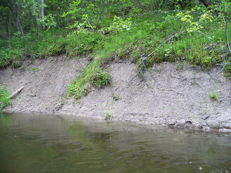
Bank Details
Which Bank? Right
Bank Aspect:E
Condition:Toe is stable; upper bank eroding
Erosion Trend:Increasing
Percent Veg. Cover: 0-10%
Bank Conditions
Stream Width:45 ft.
Stream Depth:2 ft.
Stream Current:Fast
Eroded Bank Length:20 ft.
Eroded Bank Height:5 ft.
Slope of Eroded Bank:1:1
Texture: Clay
Cause(s) of Erosion
-Bank seepage
Recommended Treatment(s)
-Bank revegetation
-Cover structure
-Tree revetments
General Information
Other Location info:minor site from earlier inventory Other Bank info:bank is slumping
Total Points
27
�