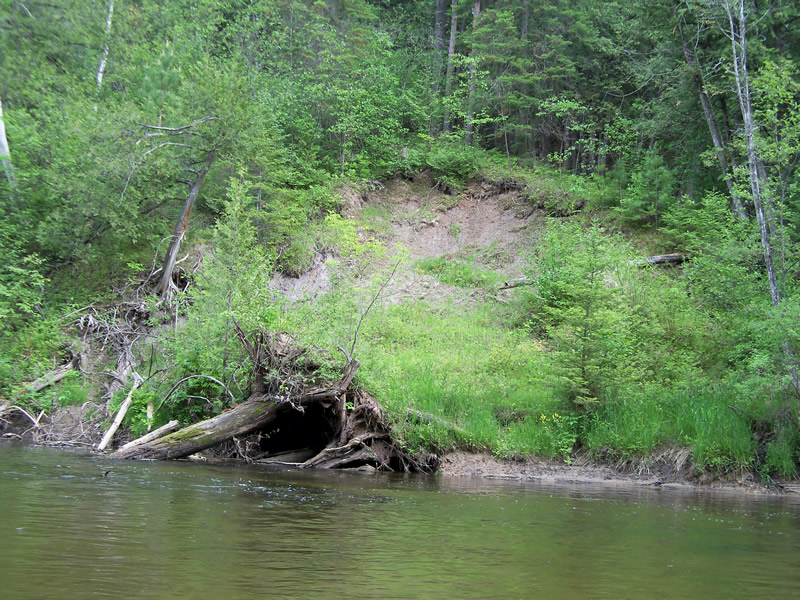
Stream Bank Erosion Site RIF_055A
Total Severity: Moderate
Total Points: 29
Information collected by:
Rifle River Watershed,
Rifle River Main Branch
Mills Twp,
Ogemaw County
GPS Coordinates: 44.20556
, -84.08333
T21N
R3E
Bank Details
Which Bank? Left
Bank Aspect:W
Condition:Toe is stable; upper bank eroding
Erosion Trend:Stable
Percent Veg. Cover: 51-100%
Bank Conditions
Stream Width:35 ft.
Stream Depth:3 ft.
Stream Current:Fast
Eroded Bank Length:30 ft.
Eroded Bank Height:30 ft.
Slope of Eroded Bank:1:1
Texture: Sand over clay
Cause(s) of Erosion
-Bank seepage
Other causes: tree fell in the river, ground slumping
Recommended Treatment(s)
-Bank revegetation
General Information
Total Points
29
�