Stream Bank Erosion Site RIF_064
Total Severity: Moderate
Total Points: 33
Information collected by:
Rifle River Watershed,
Rifle River Main Branch
Mills Twp,
Ogemaw County
GPS Coordinates: 44.19058
, -84.08021
T21N
R3E
Sec 28
Owned by Private
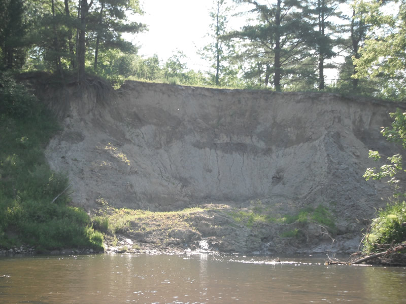
Bank Details
Which Bank? Right
Bank Aspect:E
Condition:Toe is stable; upper bank eroding
Erosion Trend:Increasing
Percent Veg. Cover: 11-50%
Bank Conditions
Stream Width:60 ft.
Stream Depth:3 ft.
Stream Current:Slow
Eroded Bank Length:300 ft.
Eroded Bank Height:40 ft.
Slope of Eroded Bank:2:1
Texture: Sand over clay
Cause(s) of Erosion
-Bend in river
-Bank seepage
Other causes: Slumping/creek
Recommended Treatment(s)
-Bank revegetation
-Tree revetments
General Information
Total Points
33
�