Stream Bank Erosion Site RIF_075
Total Severity: Severe
Total Points: 39
Information collected by:
Rifle River Watershed,
Rifle River Main Branch
Mills Twp,
Ogemaw County
GPS Coordinates: 44.18262
, -84.0739
T21N
R3E
Sec 28
Owned by Private
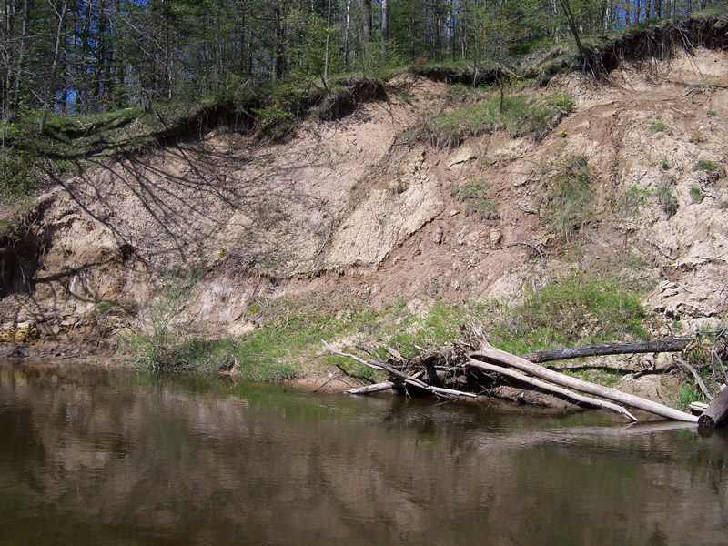
Bank Details
Which Bank? Left
Bank Aspect:W
Condition:Both toe and upper bank eroding
Erosion Trend:Increasing
Percent Veg. Cover: 11-50%
Bank Conditions
Stream Width:72 ft.
Stream Depth:2 ft.
Stream Current:Slow
Eroded Bank Length:246 ft.
Eroded Bank Height:75 ft.
Slope of Eroded Bank:1:1
Texture: Sand over clay
Cause(s) of Erosion
-Bend in river
-Bank seepage
Other causes: Slumping
Recommended Treatment(s)
-Bank revegetation
Other Treatments:Terracing of the bank
General Information
Other Location info:Located across the river from White's Canoe Livery Other Bank info:Seepage and slumping forces are at work
Total Points
39
�