Stream Bank Erosion Site RIF_076
Total Severity: Minor
Total Points: 24
Information collected by:
Rifle River Watershed,
Rifle River Main Branch
Mills Twp,
Ogemaw County
GPS Coordinates: 44.18112
, -84.07352
T21N
R3E
Sec 28
Owned by Private
Site Access:Accessible by road
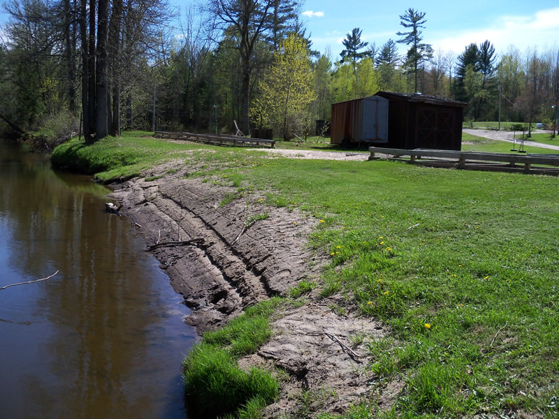
Bank Details
Which Bank? Right
Bank Aspect:E
Condition:Toe is stable; upper bank eroding
Erosion Trend:Stable
Percent Veg. Cover: 11-50%
Bank Conditions
Stream Width:75 ft.
Stream Depth:2 ft.
Stream Current:Slow
Eroded Bank Length:63 ft.
Eroded Bank Height:3 ft.
Slope of Eroded Bank:2:1
Texture: Sand over clay
Cause(s) of Erosion
-Bend in river
-Gullying
-Foot traffic
Other causes: Canoe landing
Recommended Treatment(s)
-Bank revegetation
-Constructed access
Other Treatments:Put dock in for launching canoes
General Information
Other Location info:Access point for White's Canoe Livery Other Bank info:Upstream of site has undercutting
Total Points
24
�