Stream Bank Erosion Site RIF_123A
Total Severity: Moderate
Total Points: 32
Information collected by:
Rifle River Watershed,
Rifle River Main Branch
Deep River Twp,
Arenac County
GPS Coordinates: 44.07903
, -84.03194
T19N
R4E
Sec 6
Owned by Private
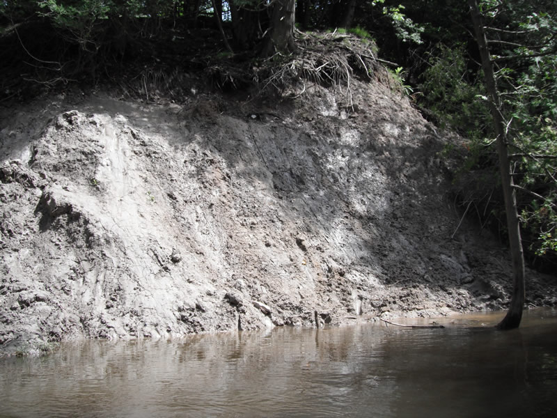
Bank Details
Which Bank? Left
Bank Aspect:W
Condition:Toe is stable; upper bank eroding
Erosion Trend:Increasing
Percent Veg. Cover: 11-50%
Bank Conditions
Stream Width:275 ft.
Stream Depth:2 ft.
Stream Current:Fast
Eroded Bank Length:50 ft.
Eroded Bank Height:12 ft.
Slope of Eroded Bank:1:1
Texture: Sand over clay
Cause(s) of Erosion
-Obstructions in river
-Bank seepage
Recommended Treatment(s)
-Bank revegetation
-Tree revetments
General Information
Total Points
32
�