Stream Bank Erosion Site BSR-37
Total Severity: Severe
Total Points: 37
Information collected by:
Big Sable River Watershed,
Freesoil Twp,
Mason County
GPS Coordinates: 44.116
, -86.20068
T20N
R16W
Sec 22
Owned by Private
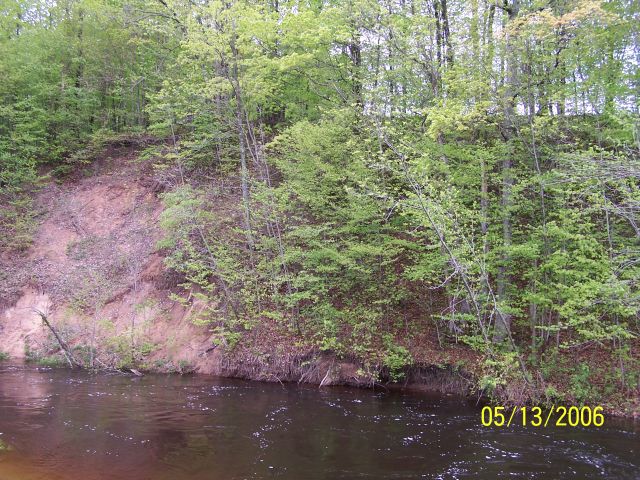

Bank Details
Which Bank? Right
Bank Aspect:SE
Condition:Both toe and upper bank eroding
Erosion Trend:Increasing
Percent Veg. Cover: 50-100%
Bank Conditions
Stream Width:30 ft.
Stream Depth:8 ft.
Stream Current:Fast
Eroded Bank Length:100 ft.
Eroded Bank Height:35 ft.
Slope of Eroded Bank:4:1 or greater
Texture: Sand
Cause(s) of Erosion
-Bend in river
Other causes: High velocties from bridge
Recommended Treatment(s)
-Bank revegetation
-Tree revetments
General Information
Total Points
37
�