Stream Bank Erosion Site BSR-45
Total Severity: Minor
Total Points: 26
Information collected by:
Big Sable River Watershed,
Grant Twp,
Mason County
GPS Coordinates: 44.12096
, -86.28114
T20N
R17W
Sec 24
Owned by Private
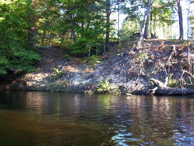
Bank Details
Which Bank? Right
Bank Aspect:S
Condition:Toe is stable; upper bank eroding
Erosion Trend:Increasing
Percent Veg. Cover: 10-50%
Bank Conditions
Stream Width:40 ft.
Stream Depth:3 ft.
Stream Current:Fast
Eroded Bank Length:40 ft.
Eroded Bank Height:15 ft.
Slope of Eroded Bank:1:1
Texture: Sand
Cause(s) of Erosion
-Foot traffic
Other causes: Cellar/storage facility built into hill
Recommended Treatment(s)
-Bank revegetation
-Constructed access
General Information
Small rental cabins on banks, just downstream fro
Total Points
26
�