Stream Bank Erosion Site RIF_227
Total Severity: Minor
Total Points: 28
Information collected by:
Rifle River Watershed,
Rifle River Main Branch
Arenac Twp,
Arenac County
GPS Coordinates: 44.04286
, -83.8543
T19N
R5E
Sec 15
Owned by Private
Site Access:Accessible by road
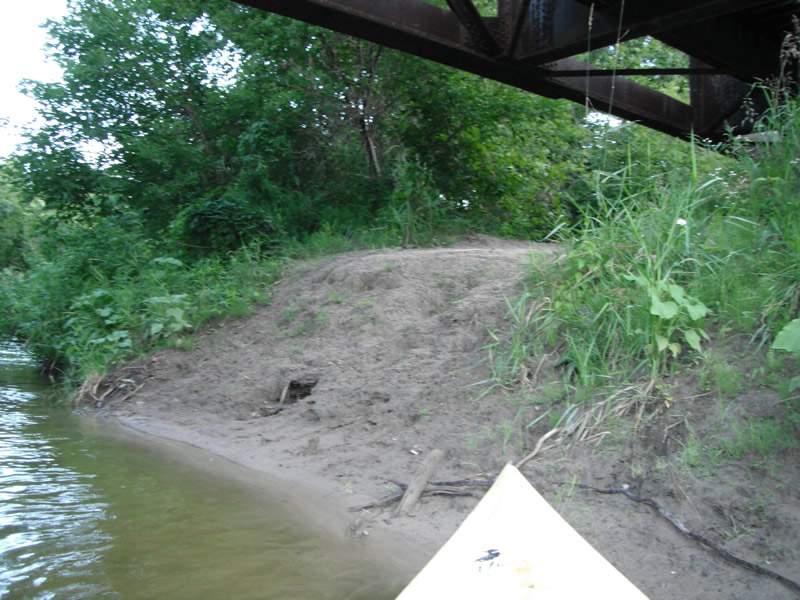
Bank Details
Which Bank? Left
Bank Aspect:W
Condition:Toe is stable; upper bank eroding
Erosion Trend:Increasing
Percent Veg. Cover: 0-10%
Bank Conditions
Stream Width:40 ft.
Stream Depth:1 ft.
Stream Current:Slow
Eroded Bank Length:25 ft.
Eroded Bank Height:10 ft.
Slope of Eroded Bank:2:1
Texture: Sand
Cause(s) of Erosion
-Foot traffic
Recommended Treatment(s)
-Bank revegetation
-Tree revetments
-Constructed access
General Information
Other Location info:WP 299
Total Points
28
�