Stream Bank Erosion Site BSR-47
Total Severity: Minor
Total Points: 24
Information collected by:
Big Sable River Watershed,
Grant Twp,
Mason County
GPS Coordinates: 44.1181
, -86.28646
T20N
R17W
Sec 24
Owned by Private
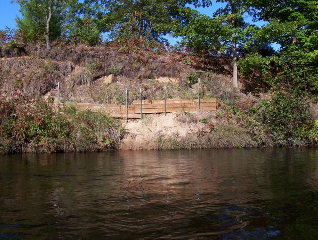
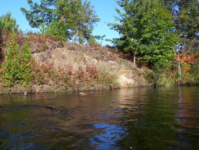
Bank Details
Which Bank? Right
Bank Aspect:E
Condition:Toe is stable; upper bank eroding
Erosion Trend:Increasing
Percent Veg. Cover: 50-100%
Bank Conditions
Stream Width:50 ft.
Stream Depth:2 ft.
Stream Current:Slow
Eroded Bank Length:40 ft.
Eroded Bank Height:15 ft.
Slope of Eroded Bank:3:1
Texture: Sand
Cause(s) of Erosion
-Bank seepage
-Foot traffic
Recommended Treatment(s)
-Obstruction removal
-Bank revegetation
-Rock riprap
Other Treatments:Needs additional rock and terraces Previous efforts installed
General Information
Total Points
24
�