Stream Bank Erosion Site RIF_245
Total Severity: Minor
Total Points: 27
Information collected by:
Rifle River Watershed,
Rifle River Main Branch
Arenac Twp,
Arenac County
GPS Coordinates: 44.02376
, -83.82963
T19N
R5E
Sec 26
Owned by Private
Site Access:Accessible by road
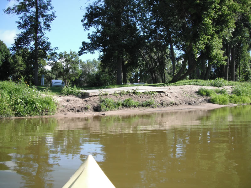
Bank Details
Which Bank? Left
Bank Aspect:S
Condition:Both toe and upper bank eroding
Erosion Trend:Increasing
Percent Veg. Cover: 11-50%
Bank Conditions
Stream Width:60 ft.
Stream Depth:1 ft.
Stream Current:Slow
Eroded Bank Length:30 ft.
Eroded Bank Height:5 ft.
Slope of Eroded Bank:3:1
Texture: Sand
Cause(s) of Erosion
-Foot traffic
Recommended Treatment(s)
-Bank revegetation
-Constructed access
General Information
Other Location info:WP 323, campground access site
Total Points
27
�