Stream Bank Erosion Site BSR-48
Total Severity: Moderate
Total Points: 30
Information collected by:
Big Sable River Watershed,
Grant Twp,
Mason County
GPS Coordinates: 44.11311
, -86.29539
T20N
R17W
Sec 24
Owned by Private
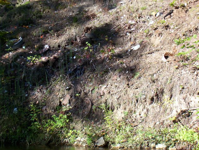
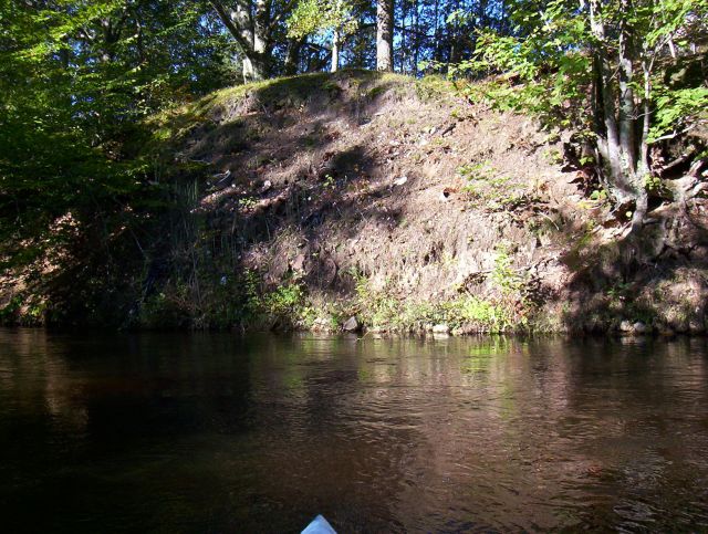
Bank Details
Which Bank? Right
Bank Aspect:E
Condition:Toe is stable; upper bank eroding
Erosion Trend:Increasing
Percent Veg. Cover: 10-50%
Bank Conditions
Stream Width:20 ft.
Stream Depth:3 ft.
Stream Current:Fast
Eroded Bank Length:50 ft.
Eroded Bank Height:20 ft.
Slope of Eroded Bank:3:1
Texture: Sand
Cause(s) of Erosion
-Bank seepage
-Foot traffic
Recommended Treatment(s)
-Obstruction removal
-Bank revegetation
-Tree revetments
Other Treatments:Trash thrown on banks for many years
General Information
House on top of bank
Total Points
30
�