Stream Bank Erosion Site BSR-49
Total Severity: Minor
Total Points: 29
Information collected by:
Big Sable River Watershed,
Grant Twp,
Mason County
GPS Coordinates: 44.10234
, -86.33762
T20N
R17W
Sec 27
Owned by Federal

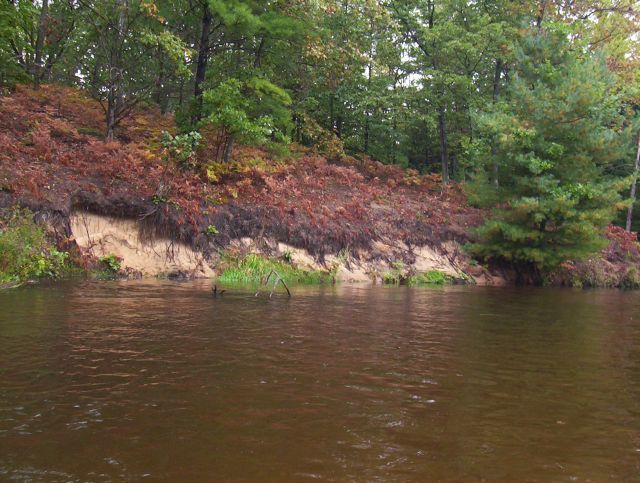
Bank Details
Which Bank? Right
Bank Aspect:E
Condition:Toe is undercutting
Erosion Trend:Increasing
Percent Veg. Cover: 50-100%
Bank Conditions
Stream Width:40 ft.
Stream Depth:3 ft.
Stream Current:Fast
Eroded Bank Length:60 ft.
Eroded Bank Height:6 ft.
Slope of Eroded Bank:3:1
Texture: Sand
Cause(s) of Erosion
-Bend in river
-Bank seepage
Recommended Treatment(s)
-Rock riprap
General Information
Total Points
29
�