Stream Bank Erosion Site RIF_WB08
Total Severity: Moderate
Total Points: 31
Information collected by:
Rifle River Watershed,
Rifle River West Branch
West Branch Twp,
Ogemaw County
GPS Coordinates: 44.27136
, -84.20962
T22N
R2E
Sec 29
Owned by Private
Site Access:Accessible by road
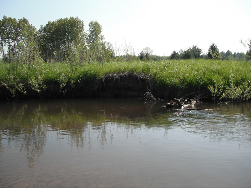
Bank Details
Which Bank? Left
Bank Aspect:W
Condition:Both toe and upper bank eroding
Erosion Trend:Increasing
Percent Veg. Cover: 51-100%
Bank Conditions
Stream Width:25 ft.
Stream Depth:3 ft.
Stream Current:Slow
Eroded Bank Length:150 ft.
Eroded Bank Height:4 ft.
Slope of Eroded Bank:1:1
Texture: Sand over clay
Cause(s) of Erosion
-Obstructions in river
-Bend in river
Recommended Treatment(s)
-Bank revegetation
-Rock riprap
-Tree revetments
General Information
Other Bank info:Upper section of site is eroding more than the lower section, tree fell in river and making bank erode
Total Points
31
�