Stream Bank Erosion Site RIF_WB12
Total Severity: Minor
Total Points: 19
Information collected by:
Rifle River Watershed,
Rifle River West Branch
West Branch Twp,
Ogemaw County
GPS Coordinates: 44.25807
, -84.2035
T22N
R2E
Sec 33
Owned by Private
Site Access:Accessible by road
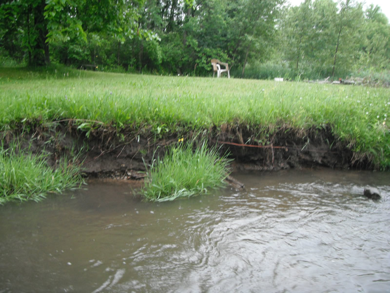
Bank Details
Which Bank? Right
Bank Aspect:NE
Condition:Toe is stable; upper bank eroding
Erosion Trend:Decreasing (Annuals Growing)
Percent Veg. Cover: 51-100%
Bank Conditions
Stream Width:15 ft.
Stream Depth:1 ft.
Stream Current:Fast
Eroded Bank Length:10 ft.
Eroded Bank Height:2 ft.
Slope of Eroded Bank:1:1
Texture: Sand over clay
Cause(s) of Erosion
-Bend in river
Recommended Treatment(s)
-Bank revegetation
-Tree revetments
Other Treatments:not a major concern, but some soft armoring would prevent erosion from high water events
General Information
Total Points
19
�