Stream Bank Erosion Site RIF_WB16
Total Severity: Minor
Total Points: 25
Information collected by:
Rifle River Watershed,
Rifle River West Branch
West Branch Twp,
Ogemaw County
GPS Coordinates: 44.25446
, -84.19945
T22N
R2E
Sec 33
Owned by Local Government
Site Access:Accessible by road
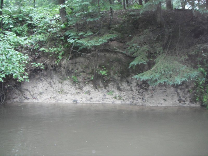
Bank Details
Which Bank? Right
Bank Aspect:W
Condition:Toe is stable; upper bank eroding
Erosion Trend:Stable
Percent Veg. Cover: 11-50%
Bank Conditions
Stream Width:20 ft.
Stream Depth:1 ft.
Stream Current:Slow
Eroded Bank Length:100 ft.
Eroded Bank Height:8 ft.
Slope of Eroded Bank:1:1
Texture: Sand over clay
Cause(s) of Erosion
-Bank seepage
Recommended Treatment(s)
-Bank revegetation
-Tree revetments
General Information
Other Location info:Wastewater treatment plant property
Total Points
25
�