Stream Bank Erosion Site RIF_WB29
Total Severity: Moderate
Total Points: 33
Information collected by:
Rifle River Watershed,
Rifle River West Branch
West Branch Twp,
Ogemaw County
GPS Coordinates: 44.25296
, -84.18107
T22N
R2E
Sec 34
Owned by Private
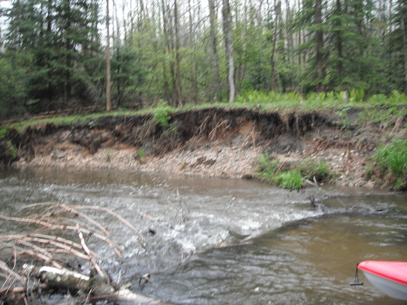
Bank Details
Which Bank? Right
Bank Aspect:NE
Condition:Toe is undercutting
Erosion Trend:Increasing
Percent Veg. Cover: 0-10%
Bank Conditions
Stream Width:40 ft.
Stream Depth:3 ft.
Stream Current:Fast
Eroded Bank Length:80 ft.
Eroded Bank Height:10 ft.
Slope of Eroded Bank:1:1
Texture: Stratified
Gravel
sand
black dirt
Gravel
sand
black dirt
Cause(s) of Erosion
-Bend in river
Recommended Treatment(s)
-Tree revetments
General Information
Other Bank info:Whole tree falling into river making erosion worse
Total Points
33
�