Stream Bank Erosion Site RIF_WB37
Total Severity: Moderate
Total Points: 32
Information collected by:
Rifle River Watershed,
Rifle River West Branch
West Branch Twp,
Ogemaw County
GPS Coordinates: 44.24965
, -84.17068
T22N
R2E
Sec 34
Owned by Private
Site Access:Accessible by road
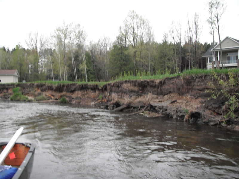
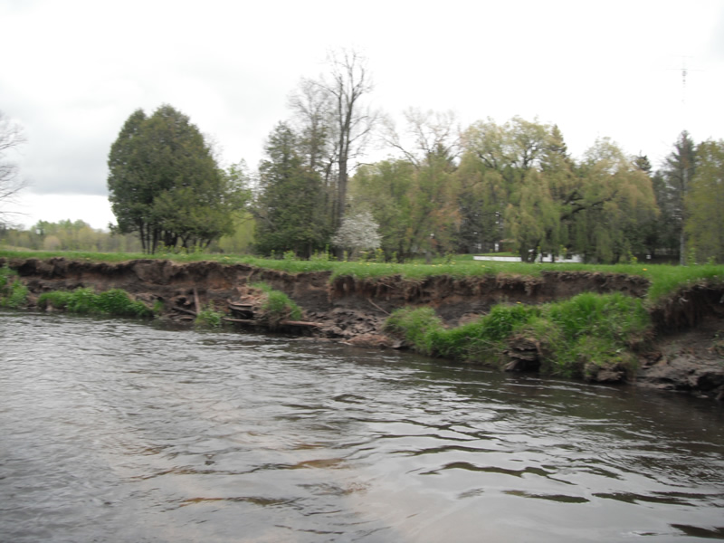
Bank Details
Which Bank? Right
Bank Aspect:S
Condition:Both toe and upper bank eroding
Erosion Trend:Increasing
Percent Veg. Cover: 11-50%
Bank Conditions
Stream Width:30 ft.
Stream Depth:1 ft.
Stream Current:Fast
Eroded Bank Length:500 ft.
Eroded Bank Height:5 ft.
Slope of Eroded Bank:1:1
Texture: Stratified
Cause(s) of Erosion
-Bend in river
Recommended Treatment(s)
-Bank revegetation
-Rock riprap
-Cover structure
-Tree revetments
General Information
Total Points
32
�