Stream Bank Erosion Site RIF_WB99
Total Severity: Minor
Total Points: 27
Information collected by:
Rifle River Watershed,
Rifle River West Branch
Mills Twp,
Ogemaw County
GPS Coordinates: 44.24597
, -84.06927
T21N
R3E
Sec 4
Owned by Private
Site Access:Accessible by road
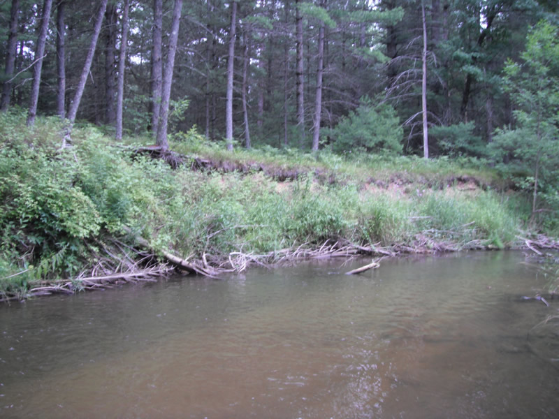
Bank Details
Which Bank? Left
Bank Aspect:S
Condition:Toe is stable; upper bank eroding
Erosion Trend:Stable
Percent Veg. Cover: 51-100%
Bank Conditions
Stream Width:20 ft.
Stream Depth:2 ft.
Stream Current:Fast
Eroded Bank Length:275 ft.
Eroded Bank Height:12 ft.
Slope of Eroded Bank:1:1
Texture: Sand over clay
Cause(s) of Erosion
-Bend in river
-Bank seepage
-Gullying
Recommended Treatment(s)
-Bank revegetation
-Cover structure
-Tree revetments
Other Treatments:Tree revetment located here, bank in good shape, 150' of 275' has been treated; on downstream portion-good project site
General Information
Total Points
27
�