Stream Bank Erosion Site BTS-001
Total Severity: Moderate
Total Points: 30
Information collected by:
Betsie River Watershed,
Betsie River
Colfax Twp,
Benzie County
GPS Coordinates: 44.58949
, -85.84895
T25N
R13W
Sec 2
Owned by State
Site Access:Accessible by Road
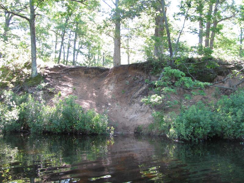
Bank Details
Which Bank? Left
Bank Aspect:NW
Condition:Both toe and upper bank eroding
Erosion Trend:Increasing
Percent Veg. Cover: 0-10%
Bank Conditions
Stream Width:40 ft.
Stream Depth:4 ft.
Stream Current:Slow
Eroded Bank Length:30 ft.
Eroded Bank Height:10 ft.
Slope of Eroded Bank:2:1
Texture: Sand
Cause(s) of Erosion
-Foot traffic
Recommended Treatment(s)
-Rock riprap
-Tree revetments
-Constructed access
General Information
Total Points
30
�