Stream Bank Erosion Site BTS-002
Total Severity: Minor
Total Points: 22
Information collected by:
Betsie River Watershed,
Betsie River
Colfax Twp,
Benzie County
GPS Coordinates: 44.58931
, -85.84909
T25N
R13W
Sec 2
Owned by State
Site Access:Accessible by Road
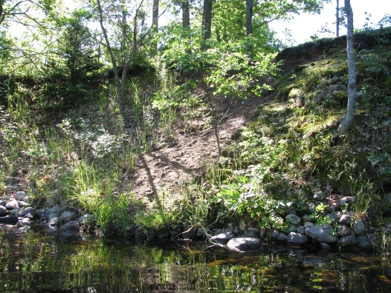
Bank Details
Which Bank? Left
Bank Aspect:NW
Condition:Toe is stable; upper bank eroding
Erosion Trend:Stable
Percent Veg. Cover: 11-50%
Bank Conditions
Stream Width:30 ft.
Stream Depth:4 ft.
Stream Current:Slow
Eroded Bank Length:30 ft.
Eroded Bank Height:12 ft.
Slope of Eroded Bank:2:1
Texture: Sand
Cause(s) of Erosion
-Foot traffic
Recommended Treatment(s)
-Bank revegetation
-Constructed access
General Information
Previously stabilized with fieldstone.
Total Points
22
�