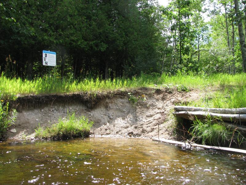
Stream Bank Erosion Site BTS-009
Total Severity: Moderate
Total Points: 29
Information collected by:
Betsie River Watershed,
Betsie River
Colfax Twp,
Benzie County
GPS Coordinates: 44.56703
, -85.89748
T25N
R13W
Sec 16
Owned by State
Site Access:Accessible by Road (0 miles)
Bank Details
Which Bank? Right
Bank Aspect:N
Condition:Both toe and upper bank eroding
Erosion Trend:Increasing
Percent Veg. Cover: 11-50%
Bank Conditions
Stream Width:15 ft.
Stream Depth:4 ft.
Stream Current:Fast
Eroded Bank Length:15 ft.
Eroded Bank Height:4 ft.
Slope of Eroded Bank:2:1
Texture: Sand
Gravel
Gravel
Cause(s) of Erosion
-Bend in river
-Foot traffic
Recommended Treatment(s)
-Rock riprap
-Constructed access
Other Treatments:Stairs have been installed before, need to redirect current away from bank and eliminate eddy/scour into bank.
General Information
Long Rd access site.
Total Points
29
�