Stream Bank Erosion Site BTS-013
Total Severity: Minor
Total Points: 24
Information collected by:
Betsie River Watershed,
Betsie River
Colfax Twp,
Benzie County
GPS Coordinates: 44.56271
, -85.91386
T25N
R13W
Sec 17
Owned by Private
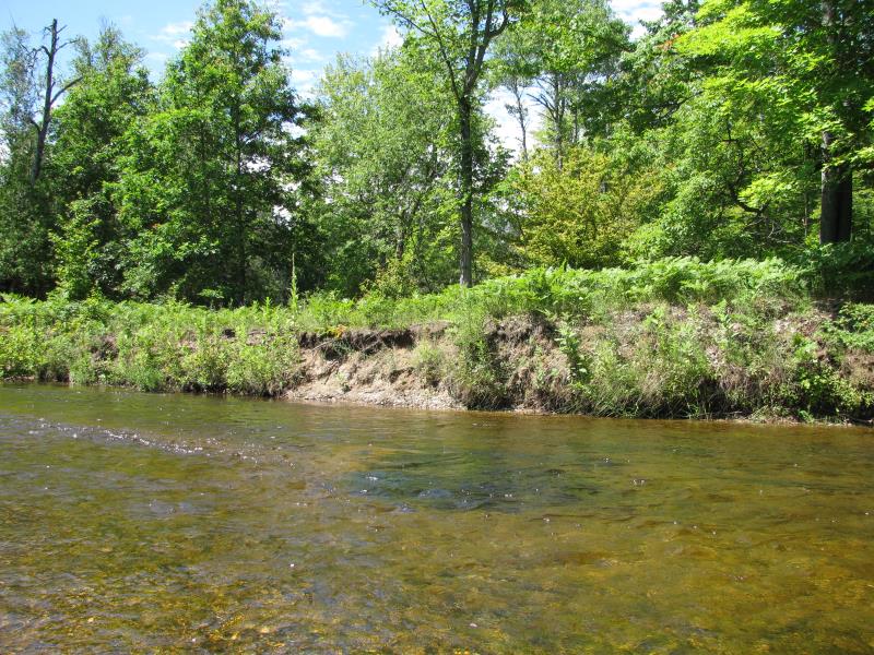
Bank Details
Which Bank? Right
Bank Aspect:E
Condition:Both toe and upper bank eroding
Erosion Trend:Stable
Percent Veg. Cover: 11-50%
Bank Conditions
Stream Width:25 ft.
Stream Depth:1 ft.
Stream Current:Fast
Eroded Bank Length:15 ft.
Eroded Bank Height:3 ft.
Slope of Eroded Bank:1:1
Texture: Sand
Gravel
Gravel
Cause(s) of Erosion
Other causes: Eddy in stream.
Recommended Treatment(s)
-Tree revetments
General Information
Directly downstream of site #12.
Total Points
24
�