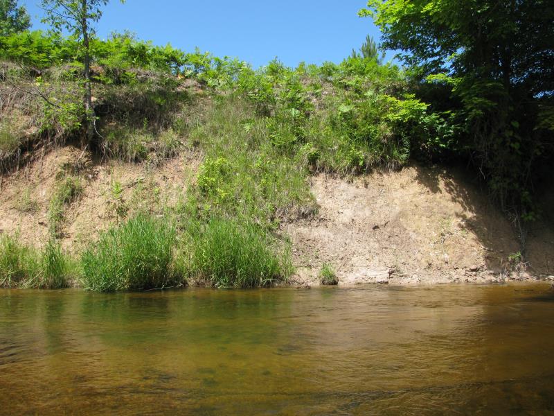
Stream Bank Erosion Site BTS-015
Total Severity: Moderate
Total Points: 29
Information collected by:
Betsie River Watershed,
Betsie River
Colfax Twp,
Benzie County
GPS Coordinates: 44.55231
, -85.92341
T25N
R13W
Sec 19
Owned by Private
Bank Details
Which Bank? Right
Bank Aspect:E
Condition:Both toe and upper bank eroding
Erosion Trend:Stable
Percent Veg. Cover: 11-50%
Bank Conditions
Stream Width:25 ft.
Stream Depth:2 ft.
Stream Current:Fast
Eroded Bank Length:40 ft.
Eroded Bank Height:12 ft.
Slope of Eroded Bank:1:1
Texture: Clay
Cause(s) of Erosion
-Bend in river
Recommended Treatment(s)
-Tree revetments
General Information
Total Points
29
�